I suspect that most of us had never heard of a region called Volhynia until we first learned of it in a discussion of Helena Zielke in late 2014 (here). Nevertheless, Volhynia has been an identifiable region since at least the tenth century. Of course, the borders of the region have shifted from time to time, as first one power incorporated Volhynia into its realm and then another engulfed part or all of Volhynia into its empire, but the general outline can be identified, as in the first map below.

A second map sets Volhynia in its modern geographical context. The red pin is located approximately in the center of Volhynia (today in northwestern Ukraine). One sees Russia to the east, Belarus to the north, and Poland to the west. The yellow star above the label Poland is the location of Schwetz (i.e., the Przechovka church), while the star in the lower right marks the Molotschna colony. Volhynia lay between the two.

During the historical period that interests us, Volhynia was divided into twelve districts, each one named for its chief city. Thus, earlier we read about some Waldheim residents coming from the Lutsk area (see here), which is a reference to the district surrounding the town of that name. We also learned that some Waldheim residents came from Novgorod Volynsk (just right of center), and we will soon encounter other residents who settled in the Rovno district (center north).

Over the course of several posts that follow, we will locate and add Mennonite villages to the map above, as a way of pinpointing the Mennonite presence in the region at particular times and places.
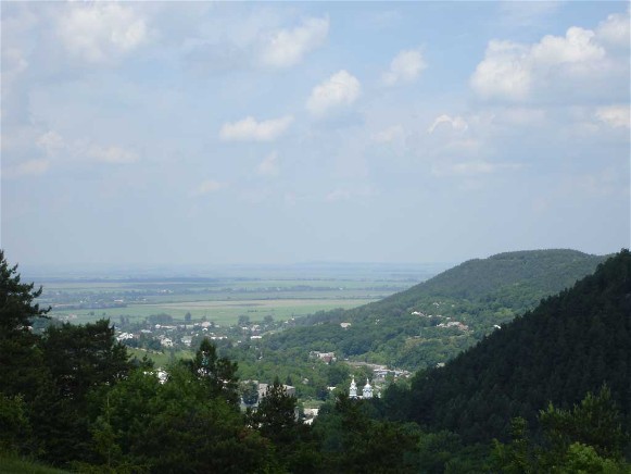 |
| The Kremianets Mountains in Volhynia. |
According to the Internet Encyclopedia of Ukraine, “Volhynia is the meeting ground of two distinct landscapes: the glacial [in the north] and the plateau [in the south]” (Hrytsak, Kubijovyč, Pasternak, and Stebelsky). In the southern part, “The northward-flowing Ikva River and Horyn River have cut deeply into the plateau and turned it into an eroded upland with mesas and pinnacles. The Kremianets Mountains, rising to 407 m above sea level, are the most picturesque part of Volhynia.”
Farther north (in the Polisia area), the terrain descends in elevation and is characterized by lowlands, marshes, and mixed forests.
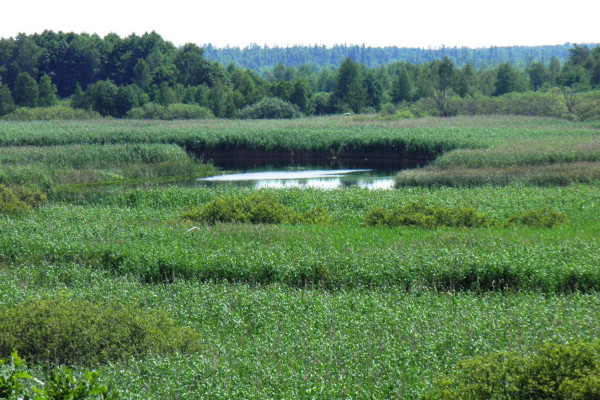 |
| The Volhynian Polisia landscape. |
Although Volhynia at that time was primarily agrarian (in fact, as of 1987, “52 percent of the population was rural, and most of it based its livelihood on agriculture”), the specific type of agriculture practiced depended on one’s location in the region. The plateau area of the south was most conducive to growing grains and other food sources, while the northern part of Volhynia was more appropriate for forestry and raising of livestock (today, dairy and hog farms).
This is the geographical context in which some Mennonites, perhaps members of our own family, lived during the early part of the nineteenth century, before they left Volhynia for Waldheim in Molotschna colony. Now that we have a better feel for the geography of Volhynia, we are ready to survey the historical time during which these people inhabited this space.
Source
Hrytsak, Petro, Volodymyr Kubijovyč, Yaroslav Pasternak, and Ihor Stebelsky. 1993. Volhynia. Internet Encyclopedia of Ukraine. Available online here.
No comments:
Post a Comment